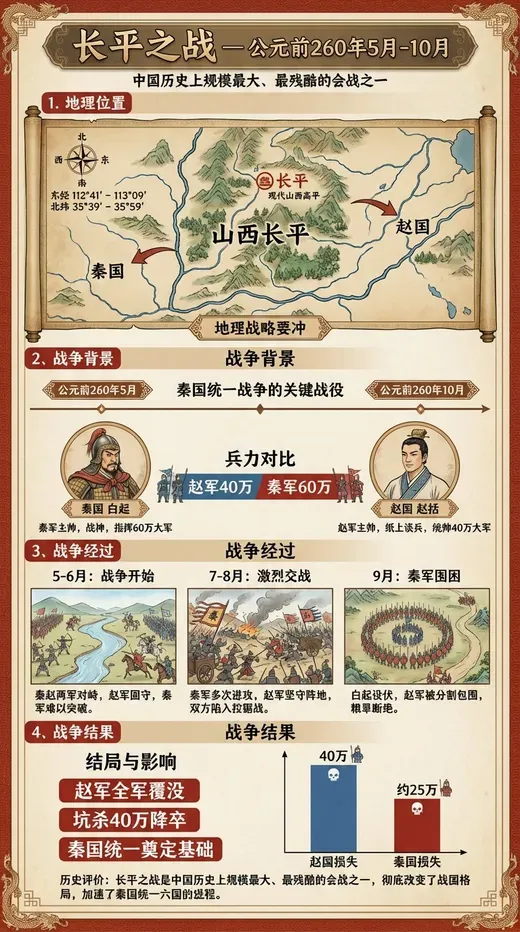
Uncover the epic scale and devastating impact of the ancient Battle of Changping, 260 BC, through a stunning series of AI-generated visuals. This collection meticulously reconstructs the pivotal conflict between the states of Qin and Zhao within precise historical coordinates (112°41′E to 113°09′E, 35°39′N to 35°59′N). Experience the strategic brilliance and tragic outcomes unfold chronologically, depicted with rich detail. Each image is complemented by vivid, Chinese-language infographics, offering deep insights into the military maneuvers, key figures, and the profound historical consequences of this defining moment in ancient Chinese warfare. Ideal for history enthusiasts and educational content, these visuals bring a crucial chapter of the Warring States period to life with unparalleled clarity and dramatic flair.